Clark Fork River Montana – One of the most interesting fisheries in the country. The location of a superfund site, it was once too polluted to be a productive fishery between it’s headwaters and Missoula. Extensive restoration efforts have improved the fishery significantly and much of the river is healthy and productive.
The removal of the Milltown dam at the confluence with the Blackfoot River has also opened the river to migratory Bull Trout and allowed the river to flush and run it’s natural course. The Clark Fork has almost every type of water imaginable. A small, winding river near the headwaters, big flat water and intense rapids. The biggest river in the state, it drains a ton of water going from the are near Anaconda, Montana into Idaho, Canada and ultimately into the Columbia River.
Flows And Weather

Rapids and Float Notes
The Alberton Gorge is the main attraction for rapids with Class III-IV ratings. The rapids change with the flows and can be big water or very technical. Outside of the Gorge, the only major rapid of concern is Cascade rapid above Plains. Cascade is a sleeper after miles of slow water. It enters a boulder field that requires some rock dodging then drops into a big run that pulls hard right. It pulls into a huge boulder. Back row to the inside seam to avoid the danger.
Clark Fork River Montana Boat Ramps
Warm Springs to Deer Lodge – Primarily a wade fishery through here. Some good sized fish hang out below the spillway. It meanders with deep undercut banks and has great looking water.
Garrison – Take the highway exit and cross the train tracks. A bridge goes over the river with a small launch area. You will likely have to slide the boat down the bank a bit. You might bang rocks in a hard boat but overall it’s pretty mild rowing all the way to Swartz Creek.
Phosphate – Take the highway exit for Phosphate to get here. It’s about a 8 mile float from Garrison. Moves pretty quick in the early season.
Gold Creek – Another 3 miles and you hit this takeout. Like most up here, it’s not an official ramp and you’ll need to winch up a bank a bit. Takeout is on river right before the bridge.
Jens – Another informal launch off an interstate exit on I-90. 5 miles below Gold Creek. Located at a bridge.
Drummond – Developed Ramp in the town of Drummond. There’s an RV park and campground as well. 13 miles from Jens.
Bearmouth – You could probably find another launch between here and Drummond if needed. Follow the frontage road and look for county bridges. It’s about 20 miles down from Drummond. The fish counts around Bearmouth and Beavertail are pretty low. Still some contaminates and issues to clean up this region. Not the most popular and you will likely have it to yourself,
Beavertail Hill – 8 miles down, there’s a nice state park and a stocked pond.
Schwartz Creek – 9 miles down. You could drag a very small boat up the bank at the Rock Creek bridge. Pontoons and canoes would work there. Schwartz Creek is accessed from Clinton. It’s a gravel bar put-in site.
Turah – 9 miles below Schwartz on river left. In low water a channel can develop right at the ramp. Make sure you son’t shoot past.
Sha-Ron/East Missoula – About 11 miles to here through great water. This was closed until about 2015-2016 and is now open. The Blackfoot River enters at Bonner, a little over half way through the float.
Osprey Stadium – Not sure on the exact mileage but it should be around 3-4. Takeout is on river left at the Osprey baseball stadium off Orange Street. Developed ramp but it’s a bit steep with a dropoff. Plan on winching your boat up a little ways.
Kelly Island – Developed launch of Reserve street in Missoula. Take Spurgin road til it ends. Right at the stop sign and left at the sign. It’s in a channel of the river and you enter the main-stem pretty quickly. There are numerous braids between the Osprey Stadium and Kelly Island. Log jams and obstacles keep most floaters away from here.
Kona Bridge – 4 miles from Kelly Island. Developed ramp on river left just before the bridge.
Harpers Bridge – 5 miles. Developed ramp on river right. Take Mullan Road to reach Kona and Harpers.
Single Tree – Off a dirt road on the west bank. Not popular. Just a tree with a slide. The shuttle is a pain but it gets a bit less pressure as a result.
Petty Creek – 23 miles below Harpers. Single Tree is not official and we don’t know the mileage exactly. This is a nice developed ramp right by the town of Alberton. Just upriver from a bridge. Boat ramp is on river left.
Rest Stop – About 4 miles down is a rest stop off the Interstate. If running your own shuttle, you will have to pass it, take the next exit and turn back. It’s a big obvious pullout for trucks. A dirt road spurs off the parking lot to a gravel bar for launching and take outs.
Cyr – The launch site for the Alberton Gorge. Launch only. A long, steep railing is used to drop your boat down. The Alberton Gorge is class II-IV rapids and is a ton of fun.
Tarkio – The most common Alberton Gorge takeout site.
Forest Grove – 4 miles down from Tarkio. It’s pretty mellow but the river can get pushy in big water.
Superior/Dry Creek – A full day with around 11 miles from Forest Grove. Good fishing. It’s a sandy ramp in the town of Superior.
Sloway – About 3 miles down. It’s slow water in low flows. Sloway isn’t much of a ramp and isn’t labeled well.
Saint Regis – 7 miles below Sloway. The St. Regis river comes in on your left after a series of highway and train bridges. The ramp is about 40 yards down on river left.
14 Mile – Great float. It’s a good pace in higher water but requires some serious forward rowing through frog water when it gets low.
Cascade – Not a developed or official launch site. You can takeout or drop a boat immediately below the Cascade rapid. It’s visible from the highway.
Pair-a-Dice – Below the confluence with the Flathead river. Developed ramp on river right above a highway bridge.
Shuttle Services
Vince the shuttle man – Does the Upper river down to Bonner 406-203-6350.
River’s Edge in Deer Lodge – Does Upper river down to Gold Creek and Jens. 406-645-2926
Four Rivers – Does most of the river. 406-370-5845
Sonja – Lower River. Not sure if she is still running in 2018. 406-822-4358
River Specific Fishing Regulations
Exceptions to Standard Regulations: Clark Fork River
Upstream from Perkins Bridge, near Warm Springs
- Open entire year
- Catch-and-release only
- Artificial lures only
- Closed to fishing from boats/vessels
Perkins Lane Bridge, near Warm Springs, to mouth of Flathead River
- Closed to fishing from about 2 1/2 miles upstream from the confluence of the Blackfoot River to about 1/2 mile downstream, as posted.
- Extended season for northern pike and whitefish and catch-and-release for trout open December 1 to third Saturday in May with artificial lures and/or maggots only.
- Catch-and-release for cutthroat trout.
- Combined trout: 3 daily and in posession, none over 15 inches.
- Northern Pike: no limit.
- Artificial lures only within a 100-yard radius of the mouths of Rattlesnake Creek, Petty Creek, Fish Creek, Cedar Creek, Dry Creek, Trout Creek, and St. Regis River.
Mouth of Flathead River to mouth of Thompson River
- Catch-and-release for cutthroat trout
- Whitefish: open entire year with maggots or lures
- Northern Pike: open entire year with bait or lures
Mouth of Thompson River to Idaho Border
- Open entire year
- Combined Trout: 5 daily and 10 in possession, only 1 over 22 inches
- Cutthroat trout: 3 daily and in possession, no size limit
- Hook and line: 2 lines with up to 2 hooks per line all year
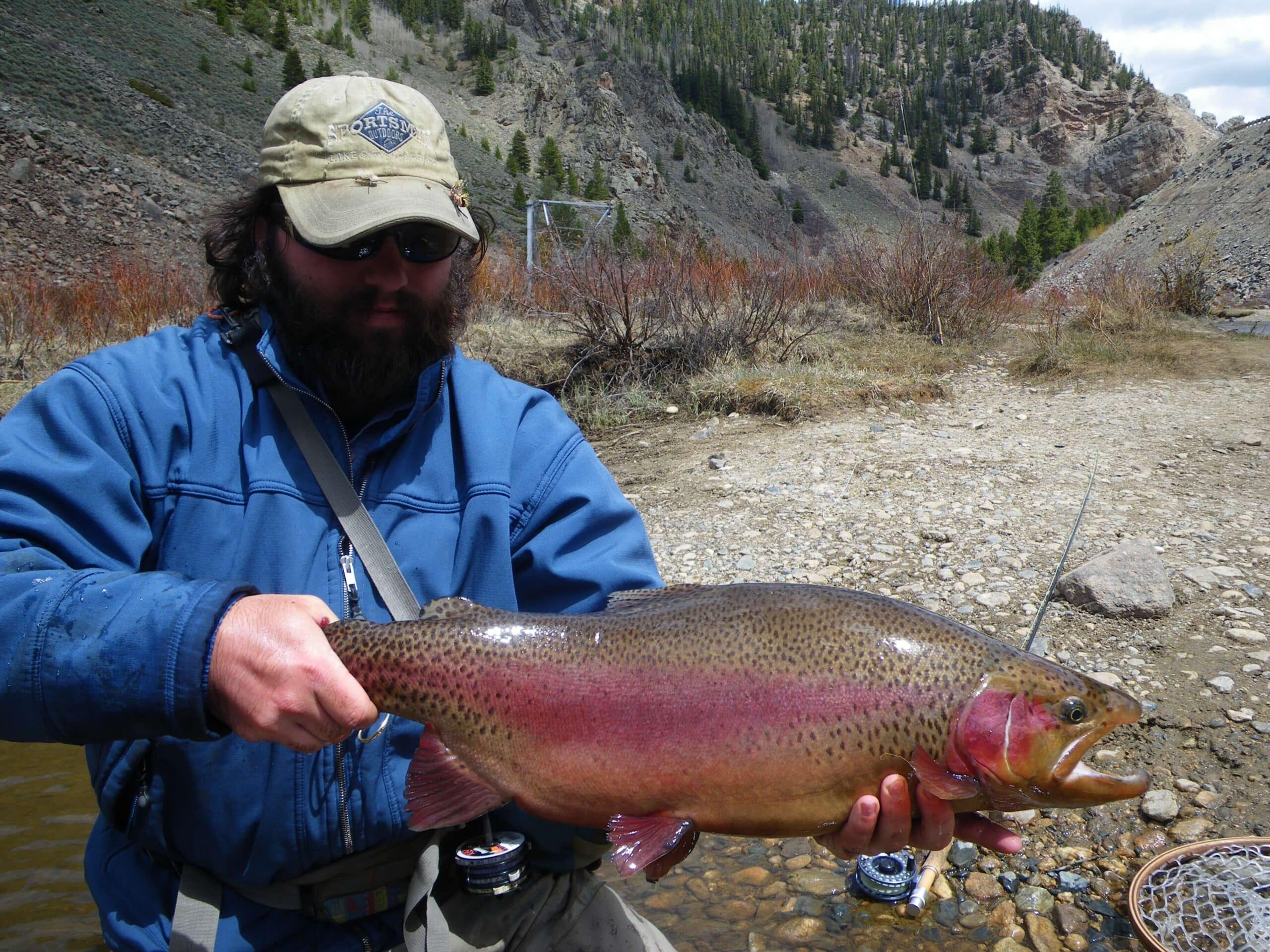
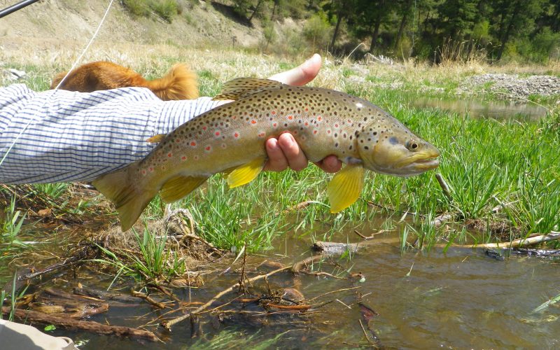
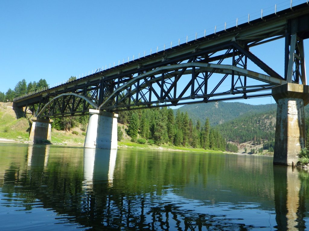
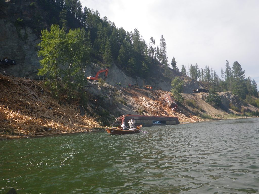
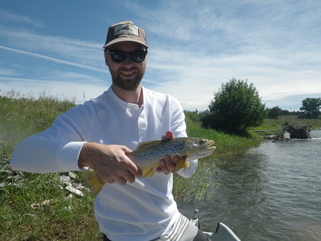
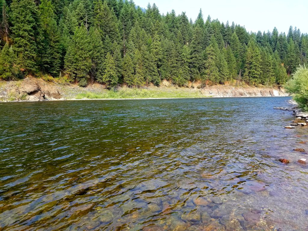
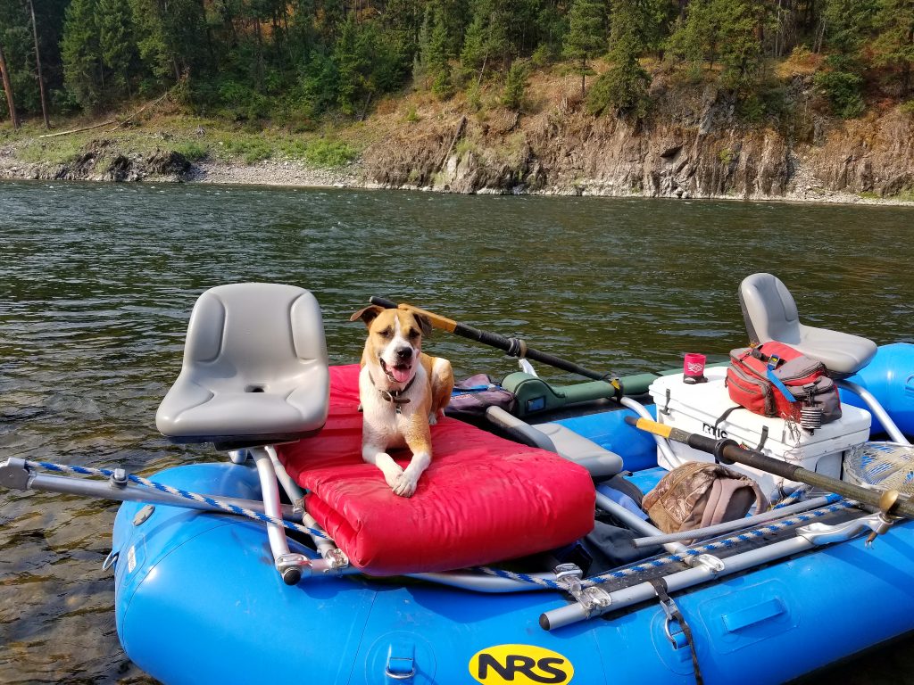
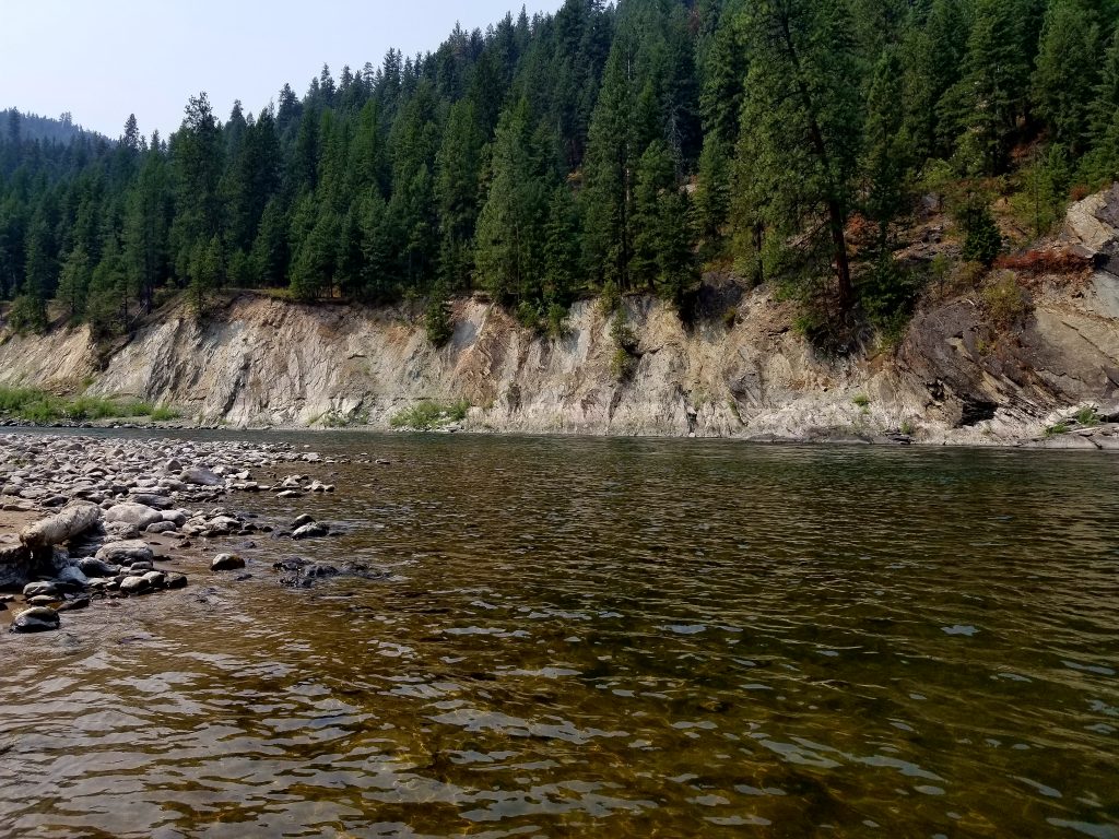
Clark Fork River Montana Photos
Submit a Trip Report, Fishing Report or Hazards Update
[user-submitted-posts]