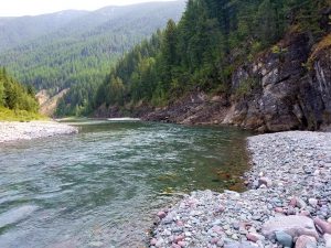
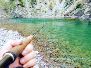
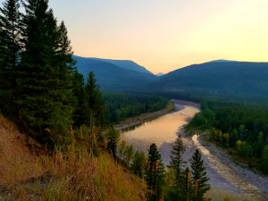
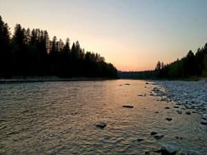
Flathead River Montana – The drainage is one of America’s coolest river systems. It flows out of deep wilderness and feeds the largest lake west of the Mississippi. The river is divided into several distinct sections.
The North Fork, Middle Fork and South Fork all come together to form the Main Stem near Columbia Falls. That flows into Flathead Lake. The outflow is completely different as it runs through the lower valley and into the Clark Fork River.
Flows And Weather
N F Flathead River nr Columbia Falls MT
- Temperature: 39.02 ° F
- Streamflow: 2700 ft³/s
- Gage height: 3.47 ft


M F Flathead River near West Glacier MT
- Temperature: 39.02 ° F
- Streamflow: 9960 ft³/s
- Gage height: 5.64 ft


S F Flathead R ab Twin C nr Hungry Horse MT
- Temperature: 39.02 ° F
- Streamflow: 9960 ft³/s
- Gage height: 5.64 ft


S F Flathead River nr Columbia Falls MT
- Temperature: 37.22 ° F
- Streamflow: 5900 ft³/s
- Gage height: 8.06 ft


Flathead River at Columbia Falls MT
- Temperature: 38.48 ° F
- Streamflow: 3480 ft³/s
- Gage height: 3.72 ft


Flathead River near Bigfork MT
- Temperature: 38.48 ° F
- Streamflow: 4310 ft³/s
- Gage height: 3.72 ft


Rapids and Float Notes
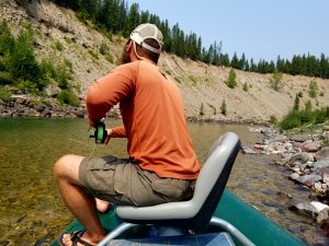 The North Fork of the Flathead is Class I-II but it has some serious danger for inexperienced floaters. Log jams and strainers are a major hazard so be extra careful here. It forms the western border for Glacier National Park and is incredibly beautiful.
The Middle Fork of the Flathead River is more whitewater intensive. It runs out of the Bob Marshall Wilderness, offering options for both wilderness trips and road access trips. The wilderness trips are done by packing horses into the wilderness or by flying into the runway at Schafer Meadows and floating out from that point. From Bear Creek to the confluence you can access the river from the highway at multiple locations.
The South Fork of the Flathead River is a different beast. 65 miles from the origin to Hungry Reservoir and almost all of it flows through remote wilderness. To access the road section above the reservoir, you still have several hours of dirt road just to get there. A short section below the Hungry Horse Dam makes up the final stretch before the confluence. It is truly wild and the Hungry Horse Reservoir dam has isolated the river, preserving westslope cutthroat genetics and bull trout populations.
The main stem flows through Columbia Falls and into Flathead Lake. It’s much broader and slower here. Below Kerr Dam and the lake it runs through a short and furious 6 miles of rapids that are best suited to rafts, kayaks and experienced paddlers. Class III-IV rapids are big and technical. After the Buffalo bridge, the river is wide, slow and full of smallmouth bass and pike. Everything below Kerr Dam runs through the Flathead Reservation and requires a license purchased directly from the reservation.
North Fork Flathead River Boat Ramps
Canada Border – A fair number of folks put-in here and run the entire 60 miles down to Blankenship Bridge at the confluence with the main-stem. It’s an ideal 2-4 day float trip without any designated camping sites.
Ford – 14 miles down makes this a good day trip option.
Polebridge – 11 miles down, this is a great option for a long day trip from the border or a shorter one from Ford. You can rent a cabin in Polebridge, grab some food at the mercantile and have a nice float without needing to camp in grizzly bear country.
Coal Creek – 9 miles below Polebridge. Another convenient day trip float.
Big Creek – Another 9 miler to here.
Blankenship Bridge – 15 miles down from Big Creek. There are a few midway point options here as well but Blankship is the most convenient takeout.
Middle Fork Flathead River Boat Ramps
Schafer Meadows – Pack or fly into this area float the wilderness stretch of the river out. It’s 27 miles and can be done in a day but multiple days are ideal for really taking your time and enjoying the river. Class III-IV rapids require experienced boaters through here as well. It’s a June-July game in most years. Big runoff can make the river too dangerous.
Bear Creek – The first road access where you can launch a boat. Hiking up or down river for wade fishing is also a good bet here. The highway veers away from the river at this point if you’re headed up Marias Pass towards East Glacier.
Essex Bridge – 5 miles down, the bridge is a nicer launch site than bear creek and is more passable in low flows. The turn comes quick and is easy to miss. Drive safe and turn around if needed.
Paola Creek – 8 miles makes this a good half day float in higher water from Essex. You could make a full day of it in lower water.
Cascadilla Creek – 11 miles down. It’s good for a long full day from Essex or an easily managed day from Paola.
Moccasin Creek – Another 8 mile run that is great for half or full day runs.
West Glacier – 6 miles down and convenient to the town of West Glacier and the entrance to Glacier National Park.
Blankenship Bridge – Common takeout point at the confluence that forms the main-stem of the Flathead river.
South Fork Flathead River Access
Wilderness access – You will need to hike or horse pack a good 25+ miles regardless of trailhead choice here. You can go in from Holland Lake or reach Young’s Creek from Ovando area trailheads.
Mid Creek Takout – This is where you will takeout from the Wilderness float. The gorge below this is insane. You need to hike out or have your gear packed out from here as well.
South Fork Road Access – The road between Hungry Horse Reservoir and the Spotted Bear Ranch has several obvious road sites where you can do a primitive launch.
Gauging Station – Access below the dam and float into the main-stem. Around 5 miles total.
Mainstem Flathead River Boat Ramps
Blankenship Bridge – The first launch site on the main stem. Also a popular takeout from the North and Middle forks.
Teakettle – 14 miles below Blankenship. FAS site.
Kokanee Bend – 3 miles down. Nice for a quick float from Teakettle. Or extend it to the next one.
Pressentine – 4 miles down.
Old Steel Bridge – 8 miles downriver.
Sportsman’s Bridge – Obvious access site. Motor boats use this often. Right above Flathead Lake.
Polson Park – The lake enters the river channel. It is slow moving and eventually you hit signs to stop before the dam area. Motorboats use this zone. Popular with water skiers in the summer.
Kerr Dam – Starts the whitewater section. Make sure you have a tribal pass.
Buffalo Bridge – 6 miles down, the river slows into a nice valley. Start smallmouth bass fishing here. Note that some motor boats do use the lower river as well.
Sloan Bridge – 20 miles to this one.
Dixon – Another 20 to the small town of Dixon.
Perma – 14 miles from Dixon. Nice mellow float through here. Last stop before the Clark Fork Confluence.
Shuttle Services and Packers
Packers – There are several operations here. I like Lazy J Bar O for the packing into the wilderness area.
Glacier Raft Company – They run the North, Middle and some main-stem. 406-888-5454
Flathead River Shuttle – 406-890-2600
Shore Thing Shuttles – Mainstem above Flathead Lake. 406-407-1602
Buffalo Bridge to Perma – 406-531-0003
Flathead River Fishing Guides
The logistics of fishing the Flathead river from a boat are not easy. Utilizing the services of an outfitter is a great move. There are a ton of rookie guides in this area however. Not a bad thing as they typically focus on whitewater and pick up fishing trips on the side. There is one dedicated outfitter in the region that is focused specifically on fishing and they run the best guides in the region. You can contact Wild Montana Anglers here to book a trip. They also partner with Lary’s Fly Shop in Columbia Falls and you can drop-in the shop for current reports and trips. Mark Fuller and Hilary Hutcheson are the premier guides for Flathead River fly fishing trips.
Call them directly at 406-261-4343 or call the fly shop at 406-897-3740.
River Specific Fishing Regulations
Exceptions to Standard Regulations: Flathead River
Flathead Lake north of Flathead Indian Reservation boundary
- Catch-and-release for cutthroat trout.
- Whitefish: 100 daily and in possession.
- Lake trout: 100 daily and in possession, only 1 over 36 inches, and all fish 30 to 36 inches must be released.
- NOTE: A Flathead Indian Reservation Tribal Permit is required to fish on the southern portion of the lake. Purchase online HERE or call tribal headquarters at 406-675-2700 for more information.
Confluence of the North and Middle forks (near Blankenship Bridge) downstream to Flathead Lake
- Extended season for whitefish and lake trout, and catch-and-release for other game fish, except northern pike, from December 1 through the third Saturday in May with artificial lures and/or maggots only. From the mouth of the Stillwater River downstream to Flathead Lake, no maggots and no scented artifi cial lures (infused, saturated or applied).
- Northern pike: extended season for northern pike from December 1 through February 28, artificial lures only.
- Catch-and-release for cutthroat trout.
- Whitefish: 100 daily and in possession.
- Combined Trout: 5 daily and in possession.
- Lake trout: 15 daily and in possession.
Flathead Indian Reservation boundary to mouth
- Open entire year.
- Bass: Open entire year, 5 daily and in possession, no size limit.
North Fork Flathead River
- Closed to angling June 1 through September 30 within a 150-yard radius of the Big Creek stream mouth unless posted at a greater distance.
- Extended season for whitefish and catch-and-release for trou open December 1 to third Saturday in May with artificial lures and/or maggots only.
- Catch-and-release for cutthroat trout.
- Combined Trout: 5 daily and in possession.
Middle Fork Flathead River Drainage
All Streams within the wilderness
- Combined Trout: 3 daily and in possessionession, none over 12 inches in rivers and streams, no size limit in lakes. Includes rainbow trout, cutthroat trout, and grayling.
Non-wilderness portion
- Combined Trout: 5 daily and in possession.
- Closed to angline June 1 through September 30 within a 150-yard radius of the Bear Creek Stream mouth.
- Extended whitefish season and catch-and-release for trout open December 1 to third Saturday in May with artificial lures and/or maggots only.
- Catch-and-release for cutthroat trout.
South Fork Flathead River Drainage
All waters upstream from Hungry Horse Damn, including Hungry Horse Reservoir and tributaries except Meadow Creek section (see below)
- Combined Trout: 3 daily limit and in possession, no fish over 12 inches in rivers and streams, no size limit in lakes. Includes rainbow trout, cutthroat trout and grayling.
Mainstem upstream from Hungry Horse Reservoir
- Bull trout: catch-and-release from the third saturday in May through July 31. A Hungry Horse/South Fork Flathead Bull Trout Catch Card must be in possession when fishing for bull trout. All bull trout must be released immediately. It is unlawful to possess a live bull trout for any reason.
Meadow Creek Bridge to Spotted Bear foot bridge and tributaries
- Catch-and-release only.
- Artificial lures only.
Hungry Horse Dam downstream to Devil’s Elbow and tributaries
- Closed entire year.
Devil’s Elbow downstream to mouth and tributaries
- Extended season for whitefish and lake trout from December 1 through the third Saturday in May with artificial lures and/or maggots only.
- Catch-and-release for cutthroat trout.
